Apr 9, 20268 min read
12 things to know before traveling to London{
"url": "london-most-interesting-streets",
"destination": "London",
"title": "london",
"city": "London",
"country": "England",
"continent": "Europe",
"refresh": 30,
"refresh_limit": 3
} Sep 22, 2020
2 MIN READ

Writer
Kansas City, MO

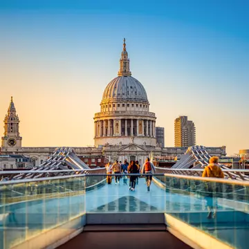
The Footways network of walking routes utilises low traffic streets for walkers to get around central London © Paul Cochrane / Footways London
{
  "url": "london-most-interesting-streets",
  "destination": "London",
  "title": "london",
  "city": "London",
  "country": "England",
  "continent": "Europe",
  "refresh": 30,
  "refresh_limit": 3
} The coronavirus pandemic is changing the way we travel on a global scale, but it’s also changing the way we move around our cities. To encourage more people to get out walking, a new map of central London has been developed that highlights the city’s quieter and more interesting streets. The project, called Footways, is the result of 18 months of developing the routes with input from local experts, neighborhood councils, businesses and cultural organizations.
https://twitter.com/hashtag/Footways?src=hash&ref_src=twsrc%5Etfw
{
  "url": "london-most-interesting-streets",
  "destination": "London",
  "title": "london",
  "city": "London",
  "country": "England",
  "continent": "Europe",
  "refresh": 30,
  "refresh_limit": 3
}
The network of walking routes covers all of Zone 1, which spans from Regent’s Park in the north to South Bank and from Whitechapel in the east to Hyde Park. It links up transport hubs with popular tourist spots, quiet roads and green spaces, making it a much more intriguing alternative than simply following the directions on Google Maps. The map is a collaboration between London Living Streets, a charity that campaigns for safe and vibrant streets, and Transport for London, which runs the city’s transport system.
‘We want walking to become a recognised form of transport again, for people to walk more and further on everyday journeys’, London Living Streets wrote in the project announcement. ‘But for walking to become a habit, it must be safe, easy and enjoyable’.
The routes cross through quieter corners of Soho, the backstreets of Southwark and even on an over-water walkway in the love-it-or-hate-it Brutalist-style Barbican building. The mapmakers hope that both Londoners and visitors to the city will explore further off the beaten track.
{
  "url": "london-most-interesting-streets",
  "destination": "London",
  "title": "london",
  "city": "London",
  "country": "England",
  "continent": "Europe",
  "refresh": 30,
  "refresh_limit": 3
} Paper copies of the new Footways maps can be picked up for free at locations across the city, purchased and posted from Urban Good or accessed online.
You may also like:
London watchlist: films to see before your trip
Virtual itineraries – a digital day out in London
How to explore London with kids
{
  "url": "london-most-interesting-streets",
  "destination": "London",
  "title": "london",
  "city": "London",
  "country": "England",
  "continent": "Europe",
  "refresh": 30,
  "refresh_limit": 3
}