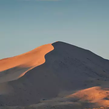
A lovely and moderate path, Teutonia Peak Trail meanders 1.5 miles up through dense Joshua tree forest and culminates near the top of Teutonia for unobstructed views of the volcanic Cima Dome. Head back the same way. The trailhead is off Cima Rd, 5 miles northwest of Cima or 11 miles south of I-15 (exit 272).
- placement: superzone
- path: destinations/pois/hero
- containerId: gpt-ad-991984170747
- possible size: [970, 250], [970, 90], [728, 90], [320, 50], [1, 1],
-
targeting:
{
  "url": "points-of-interest/teutonia-peak-trail/1638882",
  "destination": "California",
  "title": "california",
  "type": "Administrative Region",
  "continent": "North-America",
  "country": "USA",
  "refresh": 30,
  "refresh_limit": 3
}
Teutonia Peak Trail
Lonely Planet may earn a commission from affiliate links on our site. All recommendations and reviews reflect our own independent opinions.
- placement: superzone
- path: destinations/pois/middle
- containerId: gpt-ad-537761631607
- possible size: [970, 250], [970, 90], [728, 90], [320, 50], [1, 1],
-
targeting:
{
  "url": "points-of-interest/teutonia-peak-trail/1638882",
  "destination": "California",
  "title": "california",
  "type": "Administrative Region",
  "continent": "North-America",
  "country": "USA",
  "refresh": 30,
  "refresh_limit": 3
}
Must-see attractions
- Attraction in CaliforniaMojave National Preserve
-
 Attraction in CaliforniaKelso Depot Visitor Center
- placement: superzone
- path: destinations/pois/superzone
- containerId: gpt-ad-551273206769
- possible size: [970, 250], [970, 90], [728, 90], [320, 50], [1, 1],
-
targeting:
{
  "url": "points-of-interest/teutonia-peak-trail/1638882",
  "destination": "California",
  "title": "california",
  "type": "Administrative Region",
  "continent": "North-America",
  "country": "USA",
  "refresh": 30,
  "refresh_limit": 3
}